Christopher J. Bessert: Portfolio Samples
Displayed here are a very small sampling of some of the maps and other projects I have completed in the past few years. Additional examples, hardcopy and/or digital versions are always available upon request.
Jump to:
Portfolio | General | Recreation | Utility | University | Transportation | Websites
| Utility-Based Maps & Other Maps | |
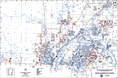 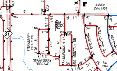 |
Plainfield Township Water Distribution Map. This map displays the entire water distribution system serving Plainfield and Alpine Townships, including portions of the City of Walker and Grand Rapids Township. Map measures 63" x 42" in size. A 400% close-up is included below the full map at the left. |
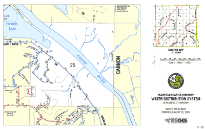 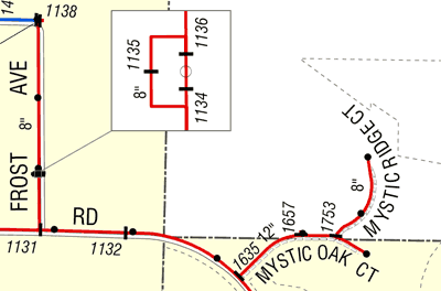 |
Plainfield Township Water Distribution Atlas. A section-by-section water distribution atlas showing similar detail as the areawide system map above, but in a convenient 11" x 17" size. Bound into books for portible use. A locator map is included on each sheet and kep maps are included at the front of the atlas. A 400% close-up in included below the full map at the left. |
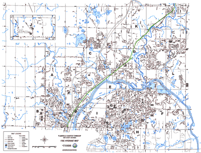 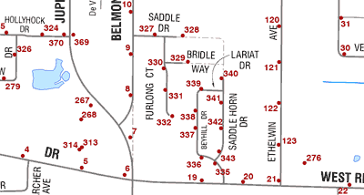 |
Plainfield Township Water Fire Hydrant Map. This map displays the entire fire hydrant system serving Plainfield and Alpine Townships, including portions of the City of Walker and Grand Rapids Township. Map measures 63" x 42" in size. A 400% close-up is included below the full map at the left. |
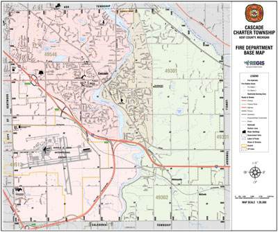 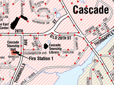 |
Cascade Township Fire Department Basemap. This map was created specifically for the firefighters and support personnel at the Cascade Township Fire Department. It consists of a base street map with all roads, hydrology and major buildings labeled. Added to that are all fire hydrants in the township, a background shading depicting the fire station "response zones," ZIP Code boundaries, and a "Restricted Burning Area" as defined by the township ordinances. Versions of this map hang on the walls of the township's fire stations and is also used as a base for all township fire department mapping needs. Map measures 20" x 17" in size. A close-up is included below the full map at left. |
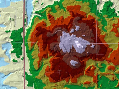 |
Elevation Map of 92nd Street Hill. This isohypse map uses two-foot contour line data and spot elevations to create this colorful rendering of this southern Kent County topographic landmark. |
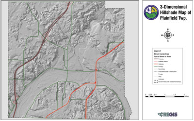 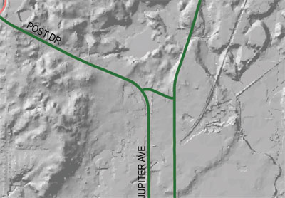 |
Three-Dimensional Hillshade Map of Plainfield Township. Using the same two-foot contour line and spot elevation data as the above 92nd Street Hill example, a greyscale hillshade map of the entirety of Plainfield Charter Township was generated with ArcInfo 9.0 and the 3-D Analyst Extension. Map measures 11" x 17" in size. A close-up is included below the full map at left. |
|
|
Jump to: Résumé | Portfolio | Technology | Contact
This is a website created, authored and maintained by Christopher J. Bessert as a portal for information about him, his GIS, mapping, cartography, transportation-planning and webmastering projects, as well as a home for his resume, portfolio and a listing of many of the computer technologies and softeware he knows how to use.