Christopher J. Bessert: Portfolio Samples
Displayed here are a very small sampling of some of the maps and other projects I have completed in the past few years. Additional examples, hardcopy and/or digital versions are always available upon request.
Jump to:
Portfolio | General | Recreation | Utility | University | Transportation | Websites
| Transportation-Related Projects | |
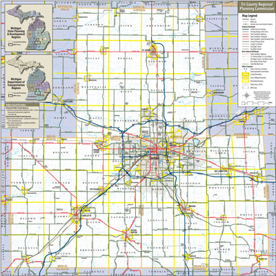 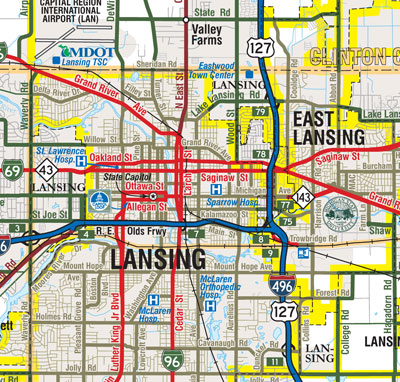 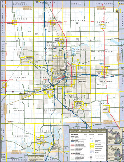 |
Michigan Metropolitan Planning Organization (MPO) Area Maps. This set of large-format maps were generated for a colleague who wanted to have a convenient, go-to reference on their office wall showing all federal-aid eligible roadways in each of the Metropolitan Planning Organization areas they were responsible for. Each map shows and names all federal-aid eligible roadways by classification of type of roadway in the MPO as well as all other, non federal-aid roadways as thin lines in the background. Also shown are major landmarks, MDOT facilities, MPO Office locations, passenger rail stations, railroads, hospitals, major shopping centers, municipal and county boundaries and, on the Benton Harbor and Niles maps, the locations of area wineries! Also included on each map are insets showing the statewide breakdown of MDOT regions and the breakdown of the regional planning organizations, each overlaid with the boundary of the MPO featured on the main map. The name and website of any public transit agencies serving that MPO area are also listed. At top left is an overview of the Lansing MPO map, while the second image is a zoomed-in excerpt of that same map showing the detail on the map. The third image is an overview of the Genesee County MPO map. |
  |
Downtown Adrian Trunkline Routing History. A project for the MichiganHighways.org website, showing the various state trunkline routes through the central portion of the City of Adrian, from 1919 to present. This shows every unique segment of current and former state trunkline highway, both by years of existence as well as by the route number(s) it carries or once carried. Red lines indicate current state trunkline routes while black lines are those streets which had formerly been a part of the state trunkline system but have now been turned back to the jurisdiction of the City. The top image at left is a thumbnail of the entire map and the bottom image is a detailed excerpt. View or download a high-resolution copy. |
  |
Capitol Loop, Downtown Lansing. Another project for the MichiganHighways.org website, this time illustrating the route of the Capitol Loop in downtown Lansing with the other existing state trunkline routes also shown. The bright red lines indicate those street segments which are part of the Capitol Loop, while the lighter red lines (and the lines in blue with black casing, in the case of freeways) are other state trunkline segments. A few of the more prominent state government buildings are also indicated on the map for orientation purposes. The top image at left is a thumbnail of the entire map and the bottom image is a detailed excerpt. View or download a high-resolution copy from MichiganHighways.org. |
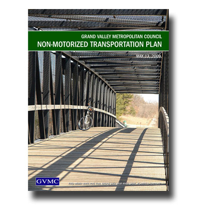 |
GVMC Non-Motorized Transportation Plan, 2009. One of the main transportation-planning documents generated by the Grand Rapids MPO, it was enhanced through the use of a unifying graphic design, color scheme, typeface selection and overall purposeful layout and design. Both a printed version and "downloadable" version for the web were created. You can download or view a copy of this 104-page document is available on the GVMC Website (PDF). |
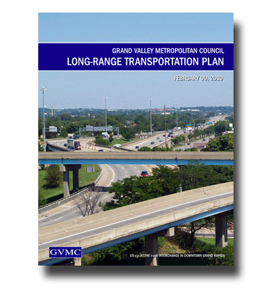 |
GVMC 2035 Long-Range Transportation Plan Update, 2011. The primary transportation-planning document generated by the Grand Rapids MPO, was released in March 2011. Like the Non-Motorized plan, the LRTP has been enhanced through a unifying graphic design, color scheme, typeface selection and overall purposeful layout and design. The document (or parts thereof) can be found at the 2035 GVMC LRTP Update website, which I composed in conjunction with the LRTP Update itself. |
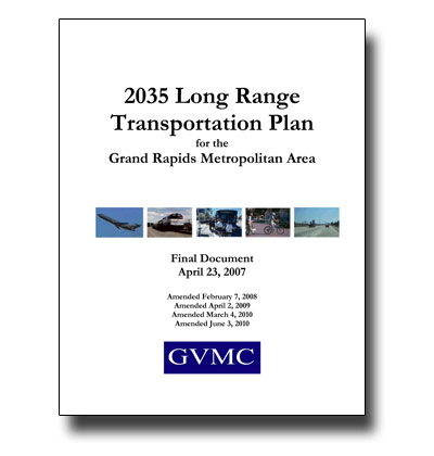 |
GVMC 2035 Long-Range Transportation Plan, 2007. The previously-approved LRTP covering the Greater Grand Rapids MPO from 2007. This document was improved from previous versions with clearer layout and design, improved maps and graphics and through the use of a document template system, simplied the ongoing update process. You can download or view a copy of this 123-page document is available on the GVMC Website. |
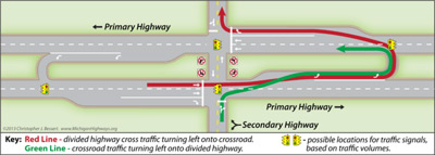 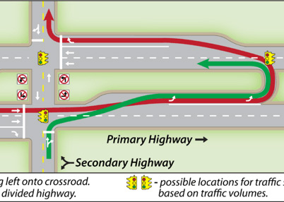 |
Michigan Left. Created for the Michigan Left section of my Michigan Highways website, many of those visiting the site are unaware of just how a "Michigan Left" even works. An earlier version of this graphic, featured on the site for over a decade, was featured in several mainstream newspaper articles, including the Traverse City Record-Eagle, and The Bay City Times. For a website redesign effort in 2013, I completely redrew the graphic which is featured at top left at 50% of its actual size and at bottom left half of the graphic is shown at actual size. Michigan Left Turn |
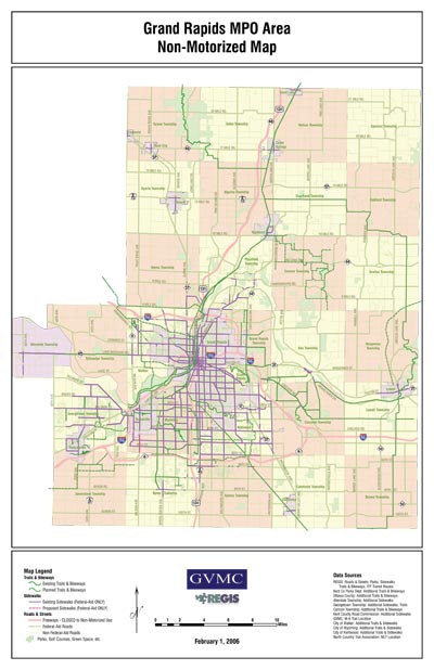  |
Grand Rapids MPO Area Non-Motorized Map. This map, and a companion detail map of just the Grand Rapids urbanized area, were created in 2006 to help in non-motorized transportation planning in the region. The focus of the maps was to highlight all non-motorized types of transportation facilities, including bicycle and hiking trails (existing and proposed), sidewalks along Federal-Aid roadways, recreational facilities, public transporation routes and hubs, etc. Both maps are 11" x 17" inches in size and a close-up is provided below the main map at left. These maps are available for viewing or downloading at the GVMC Transportation website: Main Map (PDF) GR Urban Map (PDF) |
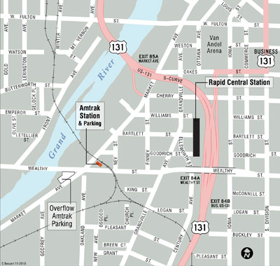 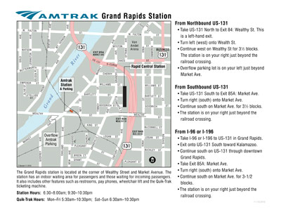 |
Grand Rapids Amtrak Station Map & Directions. Grand Rapids is home to the northern end of the increasingly-popular Pere Marquette Amtrak train. This map is an update to an earlier map for the WESTRAIN website to provide directions to the station in downtown Grand Rapids. Beside the map and some general station-related information, also include are textual directions from several of the area's major freeways to the station. You can download both the new and previous versions of the map (compare the cartographic and stylistic changes for what is, essentially, the same map data and information): New Amtrak Station Map (2010, PDF) Previous Amtrak Station Map (2004, PDF) |
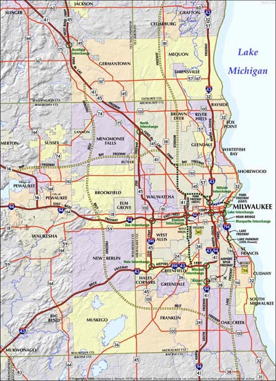 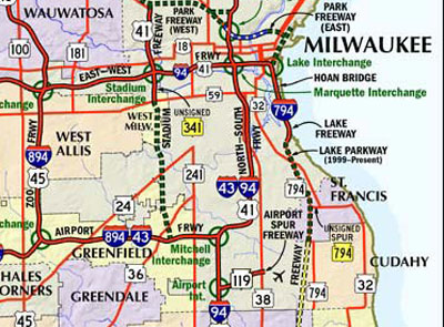 |
Milwaukee Freeway System Map. Created for my Wisconsin Highways website, this map illustrates not only the existing freeway system in Wisconsin's largest city, it also locates the many proposed-but-unbuilt freeways in the region. This map incorporates both vector GIS data and a shaded relief hillshade backdrop. The "live" version of the map is "clickable," where site visitors can simply click on any freeway segment and be taken to an in-depth article relating to that highway. Milwaukee Freeway System Map. |
|
|
Jump to: Résumé | Portfolio | Technology | Contact
This is a website created, authored and maintained by Christopher J. Bessert as a portal for information about him, his GIS, mapping, cartography, transportation-planning and webmastering projects, as well as a home for his resume, portfolio and a listing of many of the computer technologies and softeware he knows how to use.