Christopher J. Bessert: Portfolio Samples
Displayed here are a very small sampling of some of the maps and other projects I have completed in the past few years. Additional examples, hardcopy and/or digital versions are always available upon request.
Jump to:
Portfolio | General | Recreation | Utility | University | Transportation | Websites
| University Campus Maps | |
| Grand Valley State University Campus Maps | |
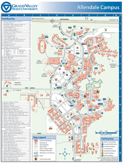 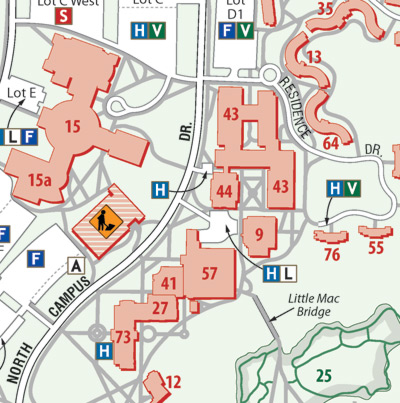 |
In 2005, GVSU felt the need to revamp the various and uncoordinated maps of their various campuses around West Michigan. I first created a unifying theme for all of the maps, featuring the exact "GVSU Blue" color supplied by the university as a prominent part of the theme. Every map features the GVSU logo in the upper left corner, a color gradient and the title aligned right. Consistent symbology and typefaces help make the entire set "feel" like they are coordinated. Both full-color and black-and-white versions of each map are created. Map measures 8.5" x 11" in size. A close-up is included below the full map at left. So far approximately a dozen maps have been created, some available for viewing or downloading on the GVSU website: • Allendale Campus • Pew Campus • CHS Map • Holland Campus • Muskegon Campus • Traverse City Campus |
| Grand Valley State University: Detroit Center Maps | |
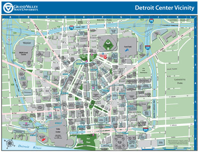 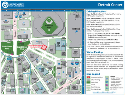 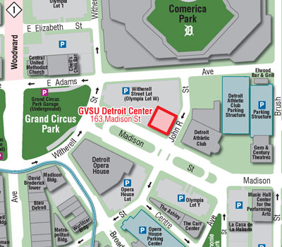 |
In 2013, Grand Valley State University purchased a building in downtown Detroit for a Detroit Center campus. Of course, the University would need a map (or two) to not only show people where the new building was and how to get to it, but also where to locate parking. While GVSU's downtown Grand Rapids campus features both lot and structure parking, visitors to the new Detroit Center facility would need to secure their own parking. This was a very complex map to create, in part due to the lack of truly useful, easily-accessible building footprint data of the downtown Detroit core. (I'm sure the City of Detroit or the Downtown Development Authority has very detailed data, but it's definitely not readily available.) After tracing each building footprint, street curb, parking lot and park off of high-resolution orthophotography, I created two maps—one a "Vicinity" map showing the entire downtown core and the access routes into it, the second a "Detail" blow-up of the area immediately surrounding the new facility. Each map measures 8.5" x 11" in size. A close-up of the "Detail" map is included below the full versions of both maps at left. |
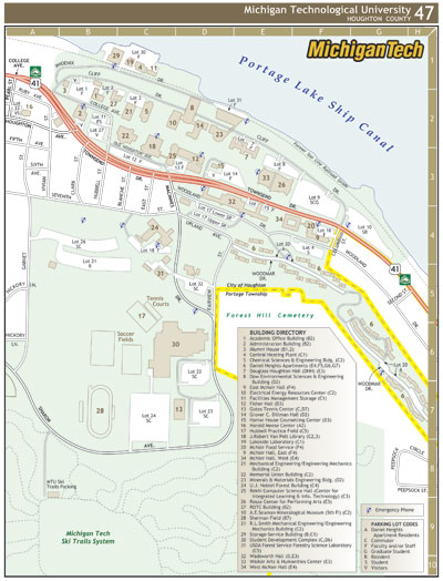 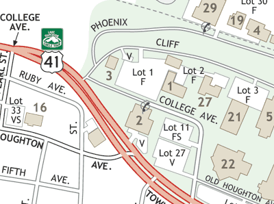 |
Michigan Technological University (MTU) Map. This map, while not commissioned nor used by the University itself, was created as part of a larger and ongoing project to map all communities of Michigan's Upper Peninsula. This project includes creating maps of every incorporated and unincorporated city, town and hamlet in all 15 U.P. counties, as well as other specialized maps of facilities such as MTU. Map measures 8.5" x 11" in size. A close-up is included below the full map at left. |
|
|
Jump to: Résumé | Portfolio | Technology | Contact
This is a website created, authored and maintained by Christopher J. Bessert as a portal for information about him, his GIS, mapping, cartography, transportation-planning and webmastering projects, as well as a home for his resume, portfolio and a listing of many of the computer technologies and softeware he knows how to use.